High Wind Watch – No Open Burning
From: Buchanan, David <dbuchanan@nullbouldercounty.org>
Sent: Saturday, February 25, 2023 5:50 PM
Subject: High Wind Watch (NO OPEN BURNING)
Importance: High
Due to the High Wind Watch forecasted by National Weather Service there will be no open burning allowed in Boulder County on Sunday 2/26 Starting at 00:01 hrs. through 2400 hrs. on Monday 2/27. Fire conditions will be elevated in areas that are free of snow cover.
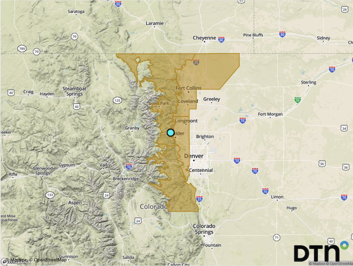
High Wind Watch URGENT – WEATHER MESSAGE National Weather Service Denver CO 208 PM MST Sat Feb 25 2023 COZ035-036-038-039-260515- Larimer and Boulder Counties Between 6000 and 9000 Feet-Jefferson and West Douglas Counties Above 6000 Feet/Gilpin/Clear Creek/Northeast Park Counties Below 9000 Feet-Larimer County Below 6000 Feet/Northwest Weld County-Boulder And Jefferson Counties Below 6000 Feet/West Broomfield County- Including the cities of Central City, Idaho Springs, Bailey, Westcreek, Loveland, Glendevey, Estes Park, Evergreen, Nunn, Arvada, Longmont, Hereford, Red Feather Lakes, Fort Collins, Lakewood, Golden, Georgetown, Boulder, and Nederland 208 PM MST Sat Feb 25 2023 …HIGH WIND WATCH IN EFFECT FROM LATE SUNDAY AFTERNOON THROUGH MONDAY MORNING… * WHAT…West winds 35 to 55 mph with gusts up to 80 mph possible. * WHERE…The Northern Front Range Foothills, The Southern Front Range Foothills, Fort Collins, and Boulder and the western suburbs of Denver. * WHEN…From late Sunday afternoon through Monday morning. * IMPACTS…Damaging winds could blow down trees and power lines. Widespread power outages are possible. Travel could be difficult, especially for high profile vehicles. Strong winds will lead to elevated fire weather conditions in areas without snow cover. PRECAUTIONARY/PREPAREDNESS ACTIONS… Monitor the latest forecasts and warnings for updates. |
David Buchanan
Fire Operations Specialist – 6563
Boulder County Sheriff’s Office
Fire Management Program
Cell (720) 527-2585
Desk ((303) 441-1483
—
You received this message because you are subscribed to the Google Groups “Gold Hill Fire Department Volunteers” group.
To unsubscribe from this group and stop receiving emails from it, send an email to volunteers+unsubscribe@nullgoldhillfire.org.
